By Emerson Luchesi
Surely you must have seen a drone flying over the area of an event, capturing images through photographs or videos. However, the use of this technological device has been adapted for various purposes. This gadget’s domestic and corporate use often involves recording various celebrations, such as concerts, and general spaces. However, this simple function has been increasingly innovative and applied to other tasks, reaching different sectors and contributing to work and development of many economic segments — agriculture is one among them.
Aiming to map and monitor crops, drones can identify problems in plantations, such as diseases, pests, sowing errors, among other situations detected through images. In addition, this tool also has precise mapping with more features of the analyzed area space and productivity, also flying over hard-to-reach locations.
Remote technology in agricultural sector
The use of drones has benefited many farmers and companies with large farms and extensive areas. Through high-quality images captured during flight, these devices provide accurate and fast information about vast spaces.
Images captured by drones are processed by specific software which provides the necessary information regarding the property, optimizing time and reducing costs for farmers. With the available data, it is possible to make decisions, plan, control, and increase the productivity of the areas while preserving the health of the soil and the entire crop. In addition to mapping and monitoring function, these devices have been used for other tasks, such as the application of inputs in plantations, like spraying and biological pest control.
Field mapping and monitoring
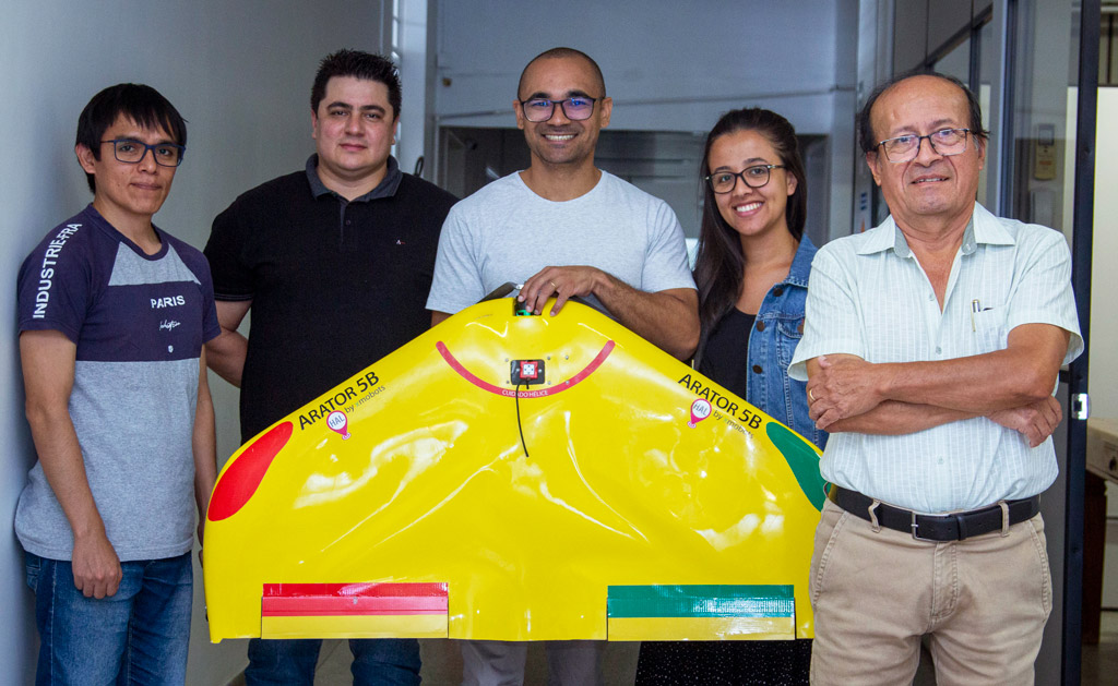
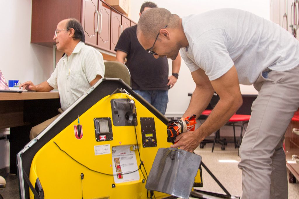
A company that has been active in this field is AgriEntech, situated in São Carlos/SP. The startup specializes in diseases and pests detection in plantations using drones.
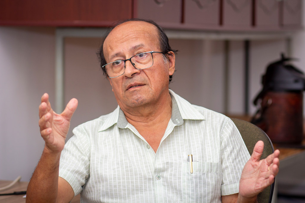
Adolfo Posadas, researcher in physics applied to agriculture and founder of the enterprise, states that the company emerged from his desire to investigate and resolve a very common issue in agricultural production: the impact of fatal diseases.
One of the initial projects in which Posadas worked at AgriEntech, through an automated system with drones and artificial intelligence, was the cartography of the orange disease known as “Citrus Greening” (HLB). This technique’s goal was to identify this bacterium in the plantation in order to combat it. The physicist further asserts that this same system can also be adjusted and employed in other crops, such as cotton, soybeans, beans, and corn.
By implementing this technology in the fields, numerous outcomes can be achieved. Some examples include precision in disease control, heightened productivity, enhanced product quality, time optimization, cost reduction, and, above all, greater sustainability.
“Our main focus is sustainability in agriculture, from the perspective of the food that is produced and also the environment”, remarks Adolfo Posadas.
How is agricultural mapping made by drones?
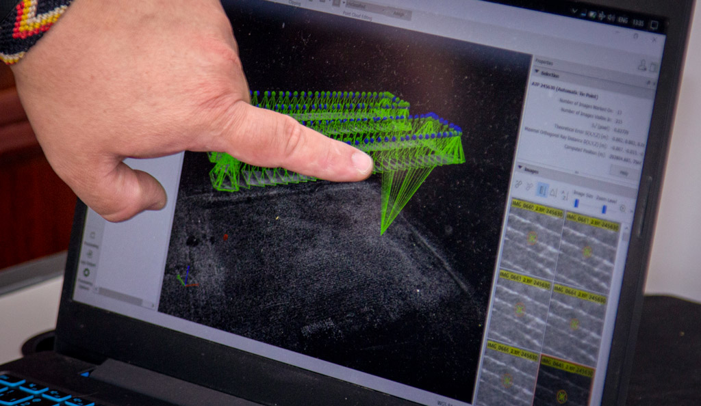
The drone is launched into the field, traversing the entire designated area, programmed to go back and forth with a previously defined flight plan. All images are recorded in high resolution and then processed by a high-performance computer with specific software. Through artificial intelligence, these materials are analyzed, providing information about the entire traversed area. The tool provides precise data on each plant, detecting which ones are diseased and which ones are healthy, as well as presenting the specific coordinates of each one through georeferencing, providing an accurate view of the crop.
“We employ this tool for disease detection, yet it can also be used for sowing errors identification and rectification, for monitoring the crop cycle from sowing to harvest, in addition to evaluating the nutritional state of plants for fertilizer application”, claims Posadas.
Different flights for different terrains
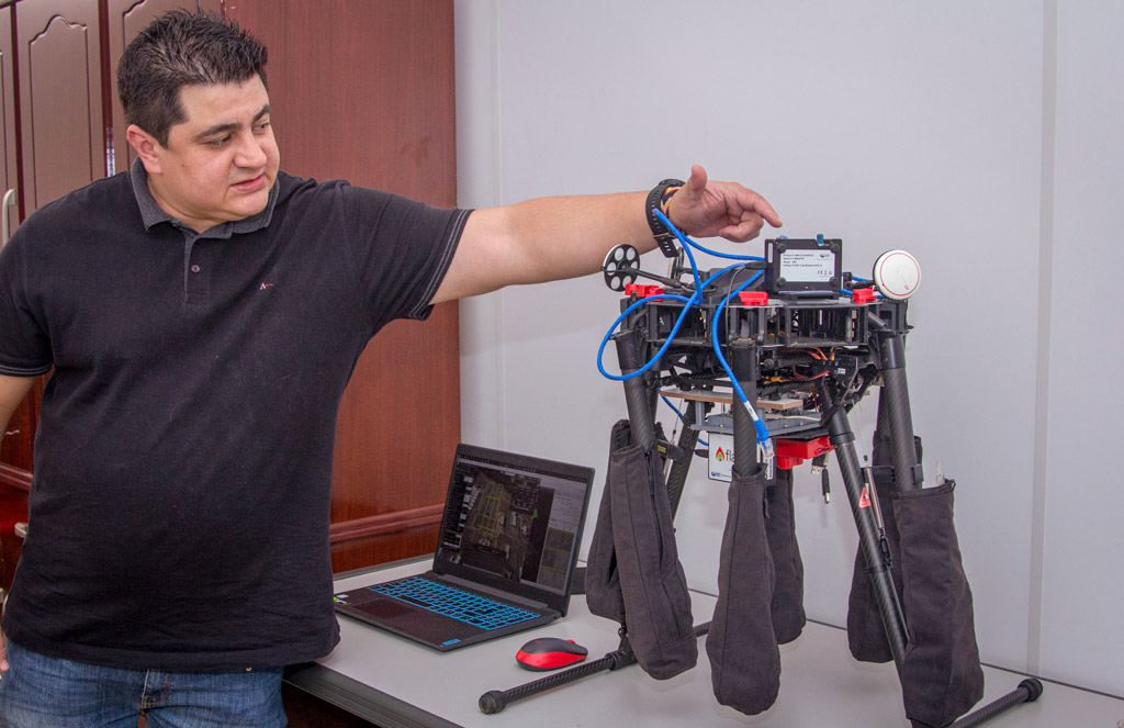
Drones are unmanned autonomous aerial vehicles that can be remotely controlled. There is a specific drone kind for each terrain type flown. José Otávio Bueno, a PhD candidate in Environmental Engineering at USP São Carlos/SP, is responsible for conducting flights for AgriEntech. He explains the difference between the two main models used by the company: multirotor and fixed-wing drones.
The multirotor drone, which has multiple rotors, is used in smaller areas due to its limited flight time and altitude, relying on a small distance between takeoff and landing base. On the other hand, the fixed-wing drone has a greater autonomy and is adopted for flying over larger spaces. It is launched by hand, returning to the ground with a parachute attached to the device.
“For example, the DJI Matrice 600 multirotor can cover approximately 50 hectares per flight, flying over two hectares in about two minutes, at a height of 50 meters. The Arator 5B fixed-wing drone can cover an area of 100 hectares in about an hour, and can fly at higher altitudes than a multirotor”, explains José Otávio.
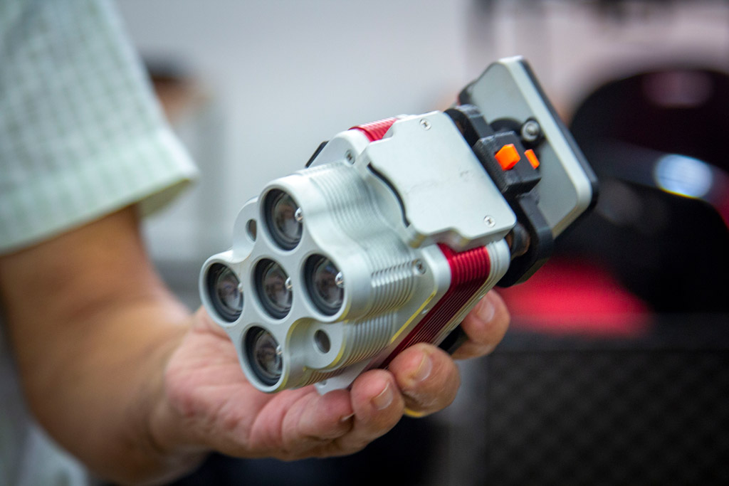
Furthermore, Robson Pereira, a Computer Science PhD student, elucidates the cameras potential for capturing images, providing virtually a scanning of the monitored area. According to him, these devices possess sensors capable of identifying and revealing information about the cultivation that is not visible to the naked eye. An example would be the multispectral cameras, which use infrared rays to detect the most detailed data of the crop.
These features demonstrate swiftness and robustness of this vital tool in mapping process field. The task of inspecting plantations, once carried out subjectively by humans, can now be swiftly, objectively, and accurately executed by technology.
Productivity and sustainability: service advantages and challenges
For accurate data acquisition, artificial intelligence important and valuable assistance is necessary. André Lourenço, a doctor in Computer Engineering and company partner, explains that AgriEntech processes the material using neural networks, which, through a mathematical model, serve to recognize patterns. In this way, it is possible to identify diseases in the crops through the collected images. Furthermore, according to the engineer, the major task of such service is to organize the information obtained through drones into a proper analysis.
“The greatest challenge is the organization of all the data for processing. Our focus is on the data and its quality, always seeking validation through field visits, as well as our constant search in scientific literature to adapt our technologies”, remarks Lourenço.
Additionally, the partner explains that localized application done by drones still faces some limitations. However, this practice has been advancing and it is something that will significantly benefit from AgriEntech’s work. “These localized application devices greatly rely on prior information about disease spots and nutritional deficiencies in plants to apply fertilizers and agrochemicals. In the future, the integration of the geolocated information we provide and the detection of problems with localized application will be very interesting”, concludes André.
There are numerous advantages that rural mapping and monitoring techniques by drones can bring to the productive areas. These technologies have increasingly advanced and provided a more advantageous cost-benefit to farmers, contributing to the productive process. Moreover, these are innovations that promote sustainable development, always considering environment preservation.
Therefore, it is worth keeping track of companies that are truly capable of providing a reliable, responsible, and technical service in order to achieve great results in agriculture through cutting-edge technologies.